
ECMWF quality
Built on ECMWF's IFS model at 0.25° resolution (about 28 km), the global model many forecasters consider the world's best.
Free · Runs in any browser
BunnyMeteo puts ECMWF's global forecast on a full-screen map with animated wind flow. See wind, rain, snow, storms and waves 15 days ahead, anywhere on Earth. Free, in any browser.
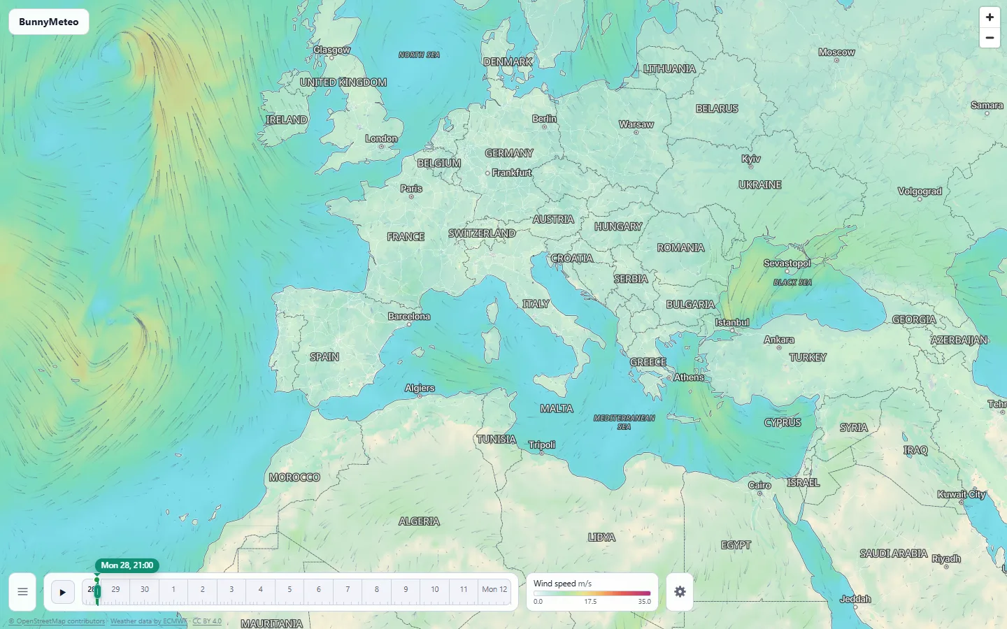
Built on ECMWF's IFS model at 0.25° resolution (about 28 km), the global model many forecasters consider the world's best.
Updated four times a day from every new model run: 00z, 06z, 12z and 18z.
A fast, full-screen weather map with an animated wind flow layer. Nothing to install, nothing to pay.
Map layers
From the wind at your door to the swell in mid-ocean. Pick a layer and scrub through time.
Wind speed, gusts and animated wind particles.
Temperature, dew point, pressure, and daily highs and lows.
Accumulated rain, instantaneous rain rate, and precipitation type: rain, snow, freezing rain, sleet and more.
Snowfall, snow depth and cloud cover.
Precipitable water, total column water and convective energy (CAPE).
Wave height, wave direction, and mean, peak and zero-crossing wave periods.
Tropical cyclones
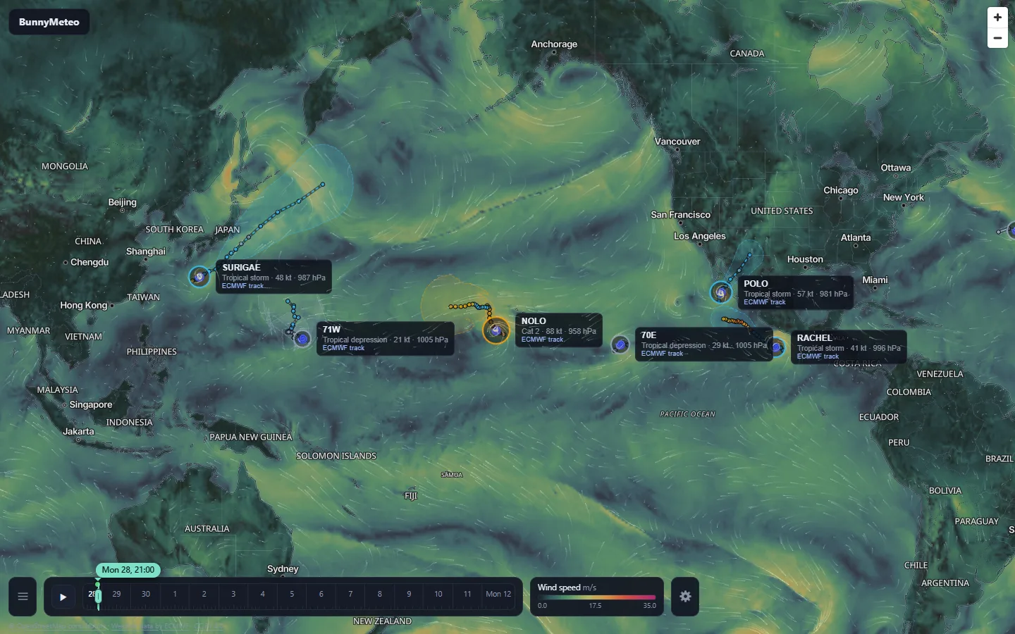
Official tracks and ECMWF's own tracker, side by side on the map.
From NHC advisories and JTWC warnings, combined with ECMWF's own tracker.
Drawn from the spread of the ECMWF ensemble, so you can see how certain the track is.
Wind speed, pressure and category for each storm, at a glance.
Point forecast
An instant readout on the map, and the full run for that spot one click away.
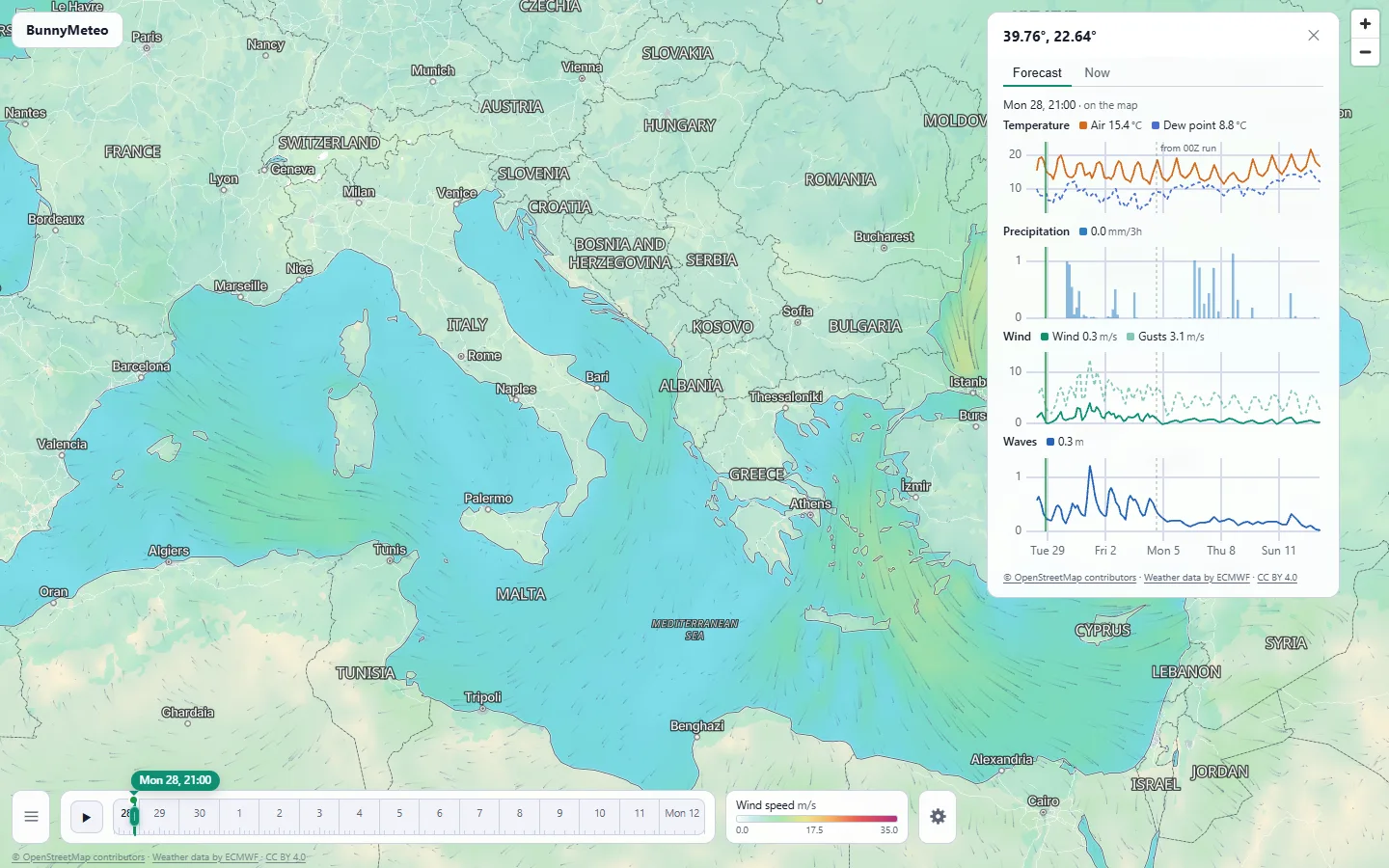
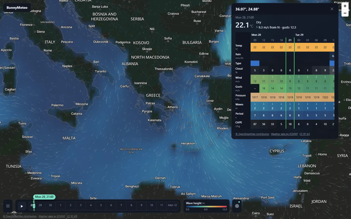
Tap any spot for the value of the current layer right there.
Open the full forecast for that point as charts over the whole run or as a detailed hourly table.
Pick an hour in the forecast and the map follows. Move the map in time and the forecast follows.
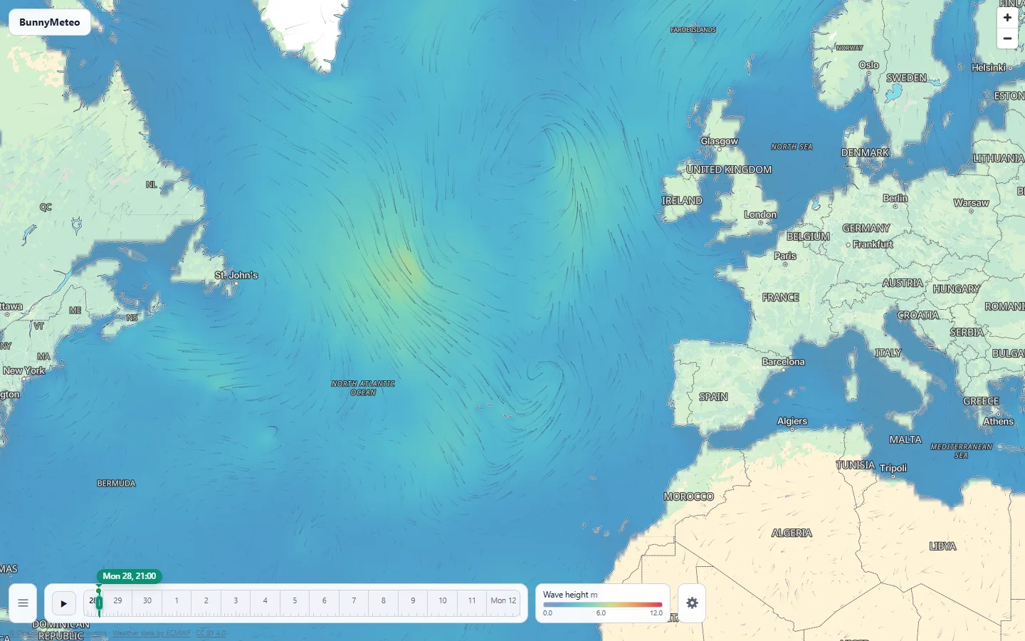
For surfers and sailors
Wave height split into period bands from 10 to 30 seconds, so you see how much of the sea is long-period swell.
Mean, peak and zero-crossing wave periods, plus wave direction.
Plan the session or the passage well ahead.
Built for everyday use
°C or °F, m/s, km/h, knots or mph, mm or inches, hPa, inHg or mmHg, metres or feet. Remembered for next time.
Map labels in your browser language, with the local-script name underneath. 12- or 24-hour clock and dates in your locale.
Light and dark themes for the panels, the basemap and the wind particles.
A colour means the same value at every hour and in every session.
An open tab switches to the new model run by itself and stays on the same forecast time.
Scrub or play through time while the next hours load ahead of you. Layer opacity is adjustable.
Yes, totally free.
From ECMWF's IFS global model at 0.25° resolution (about 28 km), published as ECMWF open data.
Four times a day, from the 00z, 06z, 12z and 18z runs. An open tab switches to the new run by itself.
15 days.
From official NHC advisories and JTWC warnings, combined with ECMWF's own tracker. The forecast cone comes from the spread of the ECMWF ensemble.
No. BunnyMeteo runs in any browser at weather.bunnycloud.gr.
Data and credits
Forecast data: contains modified Copernicus/ECMWF data, from ECMWF open data licensed under CC BY 4.0. ECMWF is not responsible for any use of this data or for BunnyMeteo. Tropical cyclone advisories: NHC and JTWC.
Basemap: Protomaps, map data © OpenStreetMap contributors.
Free, in any browser. Open the map and tap your spot.